
Ohio vs. Michigan, 1835: How the Toledo War Redrew America’s Map
 Reading Time: 14 minutes
 A Border Dispute Brings Two Neighbors to the Brink
The Toledo War was a boundary dispute between the U.S. states of Ohio and the Michigan Territory during the 1830s. Both governments claimed title to the so-called Toledo Strip, a strip of land about five miles (8 km) wide on the north side of the Ohio state line and the west bank of Lake Erie. It contained the young but expanding town of Toledo and the mouth of the Maumee River, a valuable connection between shipping on the Great Lakes and trade routes heading west.
Ohio took its claim from a boundary written into the state constitution in 1802; Michigan based its claim on the Northwest Ordinance of 1787 and the border used when Congress established the Michigan Territory in 1805. Officials in each government could therefore cite official acts of Congress and their own states as support for their claims. The conflict resulted from conflicting laws, inaccurate geography, and rival surveys, not from any clear attempt by one government to seize the land from another. By 1835, the governments had sent rival officials and militia units into the strip, bringing the neighbors to the brink of armed conflict.
The Faulty Map Behind the Dispute
The Toledo War resulted from an error made before Toledo became a major port. The Northwest Ordinance of 1787 set out rules for how the huge Northwest Territory would be carved into new states. One line in the law described a boundary running east from the southern end of Lake Michigan to Lake Erie. The line seemed straightforward on paper. In practice, the lawmakers used a map that put Lake Michigan’s southern end several miles too far north.
A widely accepted map was created by geographer John Mitchell. His map and others contained a great deal of useful information about North America. The Great Lakes had not been surveyed using modern methods. Mitchell’s map showed that a line drawn east from southern Lake Michigan would end in Lake Erie north of the Maumee River. The Maumee River’s mouth and the eventual site of Toledo would lie in the new state that formed south of that line.

Ohio Territory’s government used that understanding as it prepared for statehood in 1802. But some delegates learned reports that Lake Michigan’s southern tip was farther south than shown in old maps. If so, the Northwest Ordinance line would end in Lake Erie south of the Maumee. Ohio would no longer have direct control of the river mouth or part of the lakefront the state’s leaders believed was theirs.
The full extent of the problem became clear as surveys produced more accurate information. Lake Michigan’s southern end was far enough south to push the east–west boundary below Toledo. That result was better for Michigan Territory, which Congress created in 1805 in language related to the Northwest Ordinance. Michigan officials later claimed that the federal boundary was unambiguous and that Ohio could not change it in its constitution.
No single map was responsible for the whole conflict. The larger problem was that federal laws, state documents, and later surveys did not all match up. Congress had several opportunities to resolve the issue but let the question linger. As the region became more settled, a previously technical error took on political and economic value. By the 1830s, correcting the map meant taking land from one government and giving it to another.
Ohio Draws Its Own Northern Boundary
Ohio’s 1802 constitutional convention did not passively accept the risk created by disputed geography. The delegates included a special provision in the proposed northern boundary. If the southern end of Lake Michigan was found to lie farther south than expected, the line could angle northeastward toward Lake Erie. The goal was clear: Ohio wanted its border to reach the lake north of the Maumee River’s mouth.
Congress admitted Ohio to the Union in 1803, but the action did not resolve every question left open by that provision. Ohio read its admission as Congress’s support for the boundary as written into the Constitution. Michigan would later argue that Congress had never clearly approved Ohio’s changed line. Instead, it pointed to the 1805 law creating the Michigan Territory, which placed the border along the east–west line described in the Northwest Ordinance.
The rival claims produced rival surveys. In 1817, surveyor William Harris marked the boundary favored by Ohio. The so-called Harris Line angled northeast, placing the Maumee’s mouth within Ohio. A later federal survey associated with John Fulton followed the more southerly position claimed by Michigan. The gap between these lines formed the disputed Toledo Strip.
The strip covered about 468 square miles (1,210 km2). It was narrow, measuring roughly five miles (8.0 km) across at its western end and about eight miles (13 km) near Lake Erie. Its small size made the argument appear easy to solve. Yet, accepting either survey would determine which government could appoint officials, collect taxes, enforce laws, sell land, and control future transportation projects throughout the region.
Residents lived for years with unclear authority. Some looked to Michigan officials, and others preferred Ohio. Congress received petitions and reports, but it never imposed a final settlement. Each delay allowed the competing claims to harden. When Michigan sought statehood in the 1830s, the question could no longer remain a disagreement between surveyors. Two governments now claimed the power to draw the same boundary.

Why the Toledo Strip Mattered
The Toledo War was not a conflict over lines on a map. The Strip itself was a valuable strip of land. It sat alongside Lake Erie and the Maumee River. The river extended far into the interior. The lake connected the area to Detroit, Buffalo, and eastern markets. Control of their confluence was control over trade through an increasingly populated part of the Old Northwest.
Toledo was still a young community in the early 1830s. The nearby towns of Port Lawrence and Vistula agreed to consolidate under the name Toledo in 1833. Local boosters expected the new town to be a significant shipping hub. Boats could move farm produce toward Lake Erie, and imported farm tools and manufactured goods could travel inland from the lake. Increased land values added to the area’s potential value.
Canal construction only increased the area’s value. Ohio was already planning the Miami and Erie Canal. This waterway would link the Maumee watershed to Cincinnati and the Ohio River. A completed canal could provide a link between the Great Lakes, the Mississippi Valley, and the Gulf of Mexico. Ohio leaders had no desire for the canal’s lake terminal to fall under another government. Michigan saw no reason to give up a port within its own lawful boundaries.
The area also offered tax revenue and political representation. Settlers were building farms, businesses, and local governments. Control of the Strip meant more than owning Toledo. It meant appointing judges and sheriffs, recording deeds, supervising elections, and serving as a voice for the local population. Each official act confirmed one side’s claim and denied the other.
Later jokes frequently treat Toledo as an unimportant prize in the conflict. The joke ignores the expectations of people in the 1830s. No one could be certain how large or influential Toledo would become, but the area’s geographic advantages were easy to see. The Toledo Strip offered access to water, productive farmland, and a place in the nation’s expanding transportation network. Its economic promise turned an old survey dispute into a conflict that neither side wanted to lose.
Robert Lucas Faces Stevens T. Mason
The crisis of the boundary became personal through the actions of two resolute governors. Robert Lucas was a veteran politician and former militia officer from Ohio. Stevens T. Mason administered the Michigan Territory in his 20s and was sometimes known as the “Boy Governor”. Both men believed their voters and constituents would be betrayed by the surrender of the Toledo Strip.
Time also made compromise more difficult. Michigan had a sufficient population to petition for statehood and had started preparations for a constitutional convention in 1835. Members of Ohio’s congressional delegation made it clear that Michigan would not be admitted to the Union if the city of Toledo were within its proposed borders. Michigan considered this pressure to be a tool of an older state trying to impede its rights.

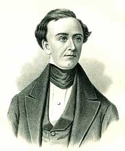
Lucas also had advantages that Mason lacked. Ohio’s congressional delegation could vote and had a voice in national elections. Michigan was still a territory and subject to direct federal oversight. Its governor could be removed by the president, and statehood would only be granted by an act of Congress. Mason answered this challenge with aggressive action, making resistance into a defense of Michigan’s legal boundary and of its future as an equal state.
The leaders also took action through government institutions to strengthen their position. Ohio formed Lucas County out of the land claimed in the disputed strip and appointed officers to prepare for court to be held in the area. Michigan continued to administer the same communities as part of Monroe County, and arrested people who tried to accept appointments under Ohio law. Both leaders issued public statements that stoked the conflict. Lucas said he would not recognize Michigan authority, and Mason called up territorial volunteers to enforce Michigan law.
Neither side wanted a deadly conflict, but each feared that failing to act decisively would allow the other to gain an advantage. Their contest transformed a federal boundary problem into a direct competition between two rival governments operating in the same communities.
Rival Laws and Governments Collide
In early 1835, the Toledo War was fought with laws. Michigan’s territorial council passed what was called the Pains and Penalties Act. It fined and threatened jail time for anyone who tried to exercise the government’s authority in the strip using Ohio law. The goal was to prevent Ohio from establishing a functioning local government to support its claim.
Ohio took action by applying its legal system to the contested area north of its official border. The state organized Lucas County, named for Governor Robert Lucas. It also appointed judges, a sheriff, and other county officials. Those residents who agreed to those positions risked arrest by Michigan authorities. They were thereby citizens of one government, while outlaws in the other’s eyes.
Officers from Michigan moved into the strip to make arrests and serve warrants. Officials from Ohio sometimes went into hiding, fled across the claimed line, or went about their duties surreptitiously. Taverns, private homes, and public gatherings were all sites for standoffs and arrest attempts. The vast majority of the incidents did not lead to major violence, but each arrest escalated tensions, reducing the chances of a peaceful resolution.
Preparations were also made for military action. Ohio passed a $300,000 military appropriation. Michigan appropriated $315,000 despite having far fewer resources. Mason called for volunteers, while Lucas organized militia units near the border. The vast majority of the activity was for show rather than combat, but the presence of armed men and rival commands was dangerous.
President Andrew Jackson sent federal commissioners Richard Rush and Benjamin C. Howard to find a temporary solution. They proposed that Ohio’s survey could continue while existing Michigan local authority could remain in place, at least until Congress settled the boundary issue. The compromise was unacceptable to both states, and they continued to enforce their incompatible laws. Surveyors and local officials found themselves on the front lines of the conflict.
Militias Enter the Toledo Strip
The “Battle of Phillips Corners” took place in April 1835. Although the name is meant to sound like a true battle, the reality was far different. Lines of opposing armies were not formed, and no one was killed. It was the result of an Ohio surveying party that had ventured into the contested region to stake out the Harris Line that Governor Lucas supported.
Michigan officials considered the survey an illegal encroachment by the Ohio government. A group of territorial militia was ordered to intercept and stop the party near a place known as Phillips Corners. The surveyors were not prepared to fight if challenged. When the Michigan men appeared, several Ohioans ran off into the woods and began heading south for safety.
Sources indicate that Michigan militiamen fired some shots over the heads of the retreating surveyors. The shooting seems to have been an act of warning rather than an attempt to kill the Ohioans. Nine men from the Ohio party were captured and held in Michigan custody. They were released a short time later, but their arrest provided both sides with fresh evidence of the other’s intransigence.
Ohio characterized the episode as an attack on peaceful officers of the law who were engaged in official business. Michigan saw it as legitimate enforcement action against individuals who had violated territorial law. Newspapers and politicians repeated the version most favorable to their side. The reality was less dramatic: armed men had interrupted a surveying party and held its officers prisoner, but neither side had chosen to turn the encounter into a deadly conflict.
Phillips Corners is significant because it showed how fragile political control of the dispute really was. A single panicked surveyor or trigger-happy militiaman might have fired directly into the other side. Retaliation would have drawn larger forces into a fight. The episode was bloodless, but it drove the two governments a few steps closer to the war that each claimed it was willing to fight.

The Two Stickney Affair
Only one action in the Toledo War has been recognized as an act of bloodshed, and it involved a family with distinctive names. Major Benjamin Stickney was an Ohio claimant with power in Toledo, and he named two of his sons One Stickney and Two Stickney. The names of these men would later help to change what might have been a deadly arrest attempt into one of the most frequently retold incidents of the conflict.
On July 15, 1835, a Michigan deputy sheriff named Joseph Wood entered Toledo intending to arrest some of the Stickney men. Michigan accused them of resisting territorial authority and of trying to act under Ohio law. The Stickneys had no intention of quietly submitting to arrest. A struggle took place as Wood and his party tried to take the men into custody.
In the course of the scuffle, Two Stickney stabbed Wood in the back with a small knife. The injury was not life-threatening, but it did make Wood the only person known to have been wounded by an act of aggression in the Toledo War. Two Stickney escaped over the Ohio line, where he was out of the ready reach of Michigan officers. Ohio officials would not give him up.
Politically, the incident was much more significant than militarily. It allowed Michigan to point to an actual armed attack on one of its officers. Ohio partisans could see the arrest attempt as yet another act of invasion of their rights. Once again, each side dealt with the same incident in terms of its own understanding of legitimate authority.
Stories that have since been told about the affair often take the form of a tavern brawl, or treat the event mostly as comedy. Details differ, and some colorful elaborations are not well supported by evidence. The well-established core of the story is well-known: a Michigan deputy sheriff tried to arrest the Stickneys, the Stickneys resisted, and Two Stickney wounded the officer before escaping. The injury did not spark a larger battle, but it did indicate that the conflict had moved beyond threats and paperwork.

Andrew Jackson Forces a Political Settlement of the Toledo War
President Andrew Jackson found himself in a situation where both law and politics played a role. His attorney general determined that Michigan’s interpretation of the federal boundary had solid legal grounds. Ohio, however, was already a state with congressional delegations and important votes in the upcoming 1836 presidential election. Michigan Territory had little national influence.
Jackson first attempted to lower the immediate stakes. He appointed commissioners to the area and encouraged both sides to agree to a temporary resolution. After Stevens T. Mason continued to contest Ohio’s claim, Jackson ousted him as territorial governor in August 1835. The move undercut Michigan’s official position, but locals soon elected Mason as governor under the state constitution.
Michigan established a state government without final congressional approval. Its voters adopted a constitution and elected officers, but Ohio’s congressional delegation worked to prevent admission until the boundary issue was resolved. Michigan could act as a state internally while remaining a territory under federal law.
Congress eventually proposed a compromise in 1836. Ohio would gain the Toledo Strip and the boundary marked by the Harris Line. Michigan would gain statehood and the western portion of the Upper Peninsula. Michigan had already claimed the peninsula’s eastern portion, but the additional territory greatly expanded the proposed state.
Many Michigan residents considered the offer an unfair trade. Toledo seemed valuable and easily accessible, while much of the Upper Peninsula seemed remote, cold, and hard to settle. Congress controlled admission to the Union, however. By making statehood dependent on the surrender of the strip, federal leaders increased the cost of continued resistance.
The Compromise That Changed the Map Forever Ending the Toledo War
Michigan’s first convention on the congressional offer was assembled in September 1836. The delegates rejected the compromise by a vote of 28–21. The majority felt Michigan should not have to surrender land promised by the Northwest Ordinance just to receive rights it had already earned by reaching a population and establishing self-government.
The rejection had real consequences. Michigan’s new government required funds, but federal payments and other privileges were withheld from non-states. Continued defiance could deplete the territory’s treasury. The convention’s opponents found support for another gathering that could accept Congress’s terms, even if many Michigan residents still felt the offer was unjust.
The second gathering met in Ann Arbor on December 14 and 15, 1836. Its legal authority was questionable because the territorial legislature had not called it through normal channels. The convention’s opponents, including many Whigs, boycotted the meeting. Winter storms and bitterness gave it its permanent nickname: the “Frostbitten Convention”.
The delegates accepted the compromise, and Congress decided to honor the decision. Michigan entered the Union as the twenty-sixth state on January 26, 1837. Ohio kept Toledo and the Toledo Strip. Michigan gained the larger western addition to the Upper Peninsula, permanently reshaping Michigan and the future borders of what would become Wisconsin.
The agreement seemed a defeat for Michigan at the time. Later discoveries of copper and iron, as well as valuable timber, revised that opinion. Ohio gained the port and river access it sought, while Michigan received thousands of square miles rich with natural resources. The Toledo War thus ended without determining a clear winner. Its lasting result was a federal compromise that reshaped the map of the Great Lakes.


